

Escuintla
Escuintla is known as the city of the palms.
Escuintla~
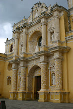
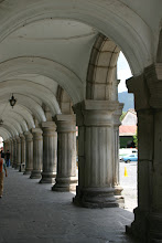
In Escuintla we find the doorway to the Pacific Ocean. Innumerable rivers bathe this area and beautiful mangroves, declared an ecological reserve zone, border its coast. It is one of the most active tourist sites in the country and today we find there the majority of the vacation villas of the residents of the capital.
In Escuintla we find the doorway to the Pacific Ocean. Innumerable rivers bathe this area and beautiful mangroves, declared an ecological reserve zone, border its coast. It is one of the most active tourist sites in the country and today we find there the majority of the vacation villas of the residents of the capital.
Its economic prosperity is the providence of the exploitation of large extensions of land in the cultivation of sugar cane and enormous livestock ranches. The modern installations of the Port of Quetzal and its intense port activity also contribute to the prosperity of this Department.
General data
Name: Escuintla.
First city: Escuintla.
Population: approximately 477,024
Cities: Escuintla, Santa Lucía Cotzumalguapa, La Democracia, Siquinalá, Masagua, Tiquisate, La Gomera, Guanagazapa, San José, Iztapa, Palín, San Vicente Pacaya and Nueva Concepción.
Weather: warm-tropical.
Language: Poqomam, kaqchiquel and spanish.
Altitude: 347 meters above sea level.
Territorial limits: It bound at north with Chimaltenango, Sacatepéquez and Guatemala; to the east with Santa Rosa; to the south with Pacífico Ocean, and to the west with Suchitepéquez.
Territorial extension: 4,384 square kilometers.
Main festivity: December 8, in honor to the Inmaculada Concepción.
Foundation: 1825
Temperature: Maximum 29.4 degrees CelsiusMinimum 18.1 degrees Celsius


0 thoughtful comments:
Post a Comment